

News Center
10
2025-04
NASA Satellite Uncovers 100,000 Hidden Mountains Beneath the Ocean
As reported by SciTech Daily, a NASA satellite has made a groundbreaking discovery, identifying approximately 100,000 previously unknown underwater mountains through advanced remote sensing technology. This revelation promises to reshape our understanding of oceanic geology and Earth’s tectonic activity.
Equipped with a cutting-edge radar altimeter, the satellite penetrated deep ocean layers to map subtle seafloor variations. Data analysis revealed these mountains, averaging over 1,000 meters in height, with some rivaling terrestrial ranges like the Alps. Researchers hypothesize links to plate tectonics and volcanic activity, offering fresh insights into planetary dynamics.
The mission leveraged international collaboration, drawing on methodologies from ESA’s Corot satellite, which monitored stellar brightness for exoplanet detection—a technique adapted for undersea mapping14. NASA plans to deploy AI for deeper data analysis, focusing on how these formations influence ocean currents and biodiversity.
- share


-
29
2025-05
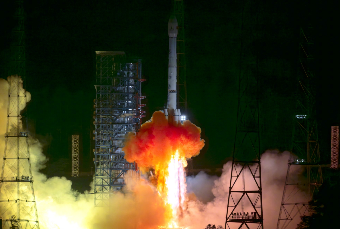
Tianwen-2 Mission Launched Successfully
At 1:31 AM today, China successfully launched the Tianwen-2 planetary exploration probe from the Xichang Satellite Launch Center using the Long March-3B Y110 carrier rocket.
-
13
2025-05
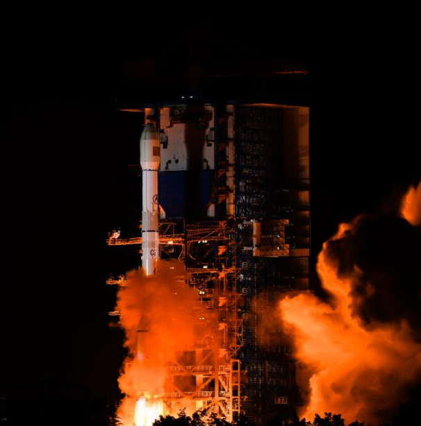
Communication Technology Experiment Satellite No. 19 Successfully Launched
At 2:09 on May 13, China successfully launched the Communication Technology Experiment Satellite No. 19 from the Xichang Satellite Launch Center using a Long March 3B carrier rocket. The satellite smoothly entered its predetermined orbit, and the launch mission was a complete success.
-
12
2025-05
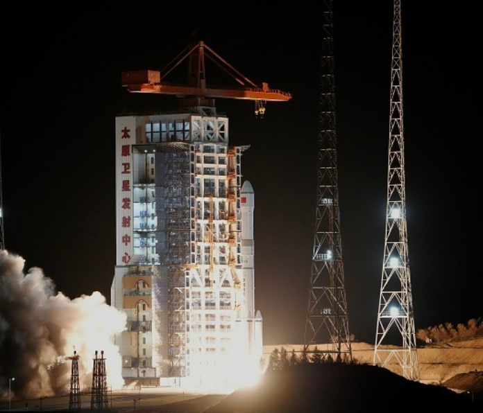
Remote Sensing Satellite No. 40, Group 02, Successfully Launched
On May 11 at 21:27, China successfully launched the Remote Sensing Satellite No. 40, Group 02, from the Taiyuan Satellite Launch Center using a Long March 6A carrier rocket. The satellite entered its predetermined orbit smoothly, and the launch mission was a complete success.
contact us
-
Dubai headquarters
Address:
Units 610 & 611, Level 3, The Offices 3, One Central Dubai World Trade Centre, Dubai
Phone:
(+971) 04 594 3961
-
Hong Kong headquarters
Address:
15/F, Data Technology Hub, 5 Chun Cheong Street, Tseung Kwan O Industrial Estate, New Territories, Hong Kong
Phone:
(+852) 2161 8300
-
E-mail
ir@uspace.com


